
KMUTT Geospatial Engineering and Innovation Center
King Mongkut's University of Technology Thonburi
126 Pracha Uthit Road, 10140 Bangkok
Copyright (c) 2008 Sitename.com. All rights reserved.

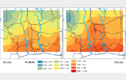
โครงการระบบติดตามและประเมินความเค็มในดินเชิงพื้นที่และเชิงเวลาโดยใช้กระบวนการสถิติ เชิงพื้นที่ ในพื้นที่ลุ่มน้ำบางปะกง เจ้าพระยา ท่าจีน และแม่กลอง
Customer National Research Council of Thailand (NRCT) การติดตามการรุกล้ำของน้ำเค็มโดยการนำระบบสารสนเทศภูมิศาสตร์ มาวิเคราะห์ร่วมกับข้อมูลคุณสมบัติของดินจากการสำรวจภาคสนาม ข้อมูลที่ได้สามารถนำมาประมวลผลแสดงขอบเขตพื้นที่และระดับความรุนแรงของความเค็มในดินแต่ละช่วงเวลาได้ นำไปสู่การเป็นข้อมูลสนับสนุนเพื่อวางแผนการทำเกษตรกรรมในพื้นที่ และการบริหารจัดการน้ำเพื่ออุปโภค บริโภค
Read more.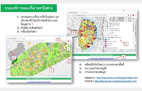
Knowledge management for developing urban innovation District
Customer National Innovation Agency (Public Organization) (NIA) การพัฒนาพื้นที่ไปสู่ย่านนวัตกรรมที่เหมาะสมกับบริบทของแต่ละพื้นที่จึงมีความแตกต่างกัน เนื่องจากลักษณะทางกายภาพ สังคมและวัฒนธรรมของแต่ละพื้นที่จะมีความเฉพาะ ทำให้ต้องอาศัยข้อมูลมาทำการวิเคราะห์เพื่อพัฒนาเป็นแผนแม่บทของการพัฒนาพื้นที่แม่นยำและถูกต้อง ดังนั้นการเข้าใจบริบทของพื้นที่จึงจำเป็นต้องอาศัยข้อมูลที่ครอบคลุมและครบถ้วนเพื่อช่วยในการสนับสนุนการตัดสินใจสำหรับพัฒนาเป็นแผนแม่บทของย่านนวัตกรรมที่สนใจ ดังนั้นการนำเทคโนโลยีเชิงพื้นที่ ทั้งระบบสารสนเทศภูมิศาสตร์
Read more.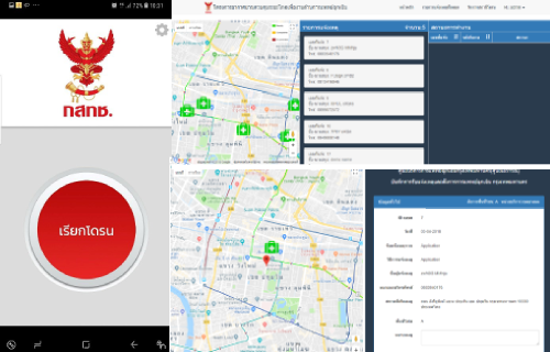
โครงการระบบแผนที่เพื่อติดตามสถานการณ์ของหน่วยดำเนินกลยุทธ์ทหารบกด้วยวิทยุสื่อสารทางทหาร
Customer The National Broadcasting and Telecommunications Commission โครงการอากาศยานไร้นักบินเพื่องานด้านการแพทย์ฉุกเฉิน (สำหรับผู้ที่มีภาวะหัวใจหยุดเต้นเฉียบพลัน) ศูนย์ฯ ร่วมดำเนินงานกับ สถาบันวิทยาการหุ่นยนต์ภาคสนาม โดยศูนย์ฯ รับผิดชอบในส่วนของการพัฒนาระบบสำหรับผู้ดูแลการแจ้งเตือน
Read more.
GIS Health Workshop @ Khon Kaen University
Date: 29-30 March 2018 Participant: 100 people Venue Khon Kaen University GeoS4S Module: Geo-application Development & GIS for
Read more.
“Why Location Strategy Matter for Business?”
Date: 21 November 2017 Participant: 16 people Venue Science connect meeting room, Science Building, 1st Floor
Read more.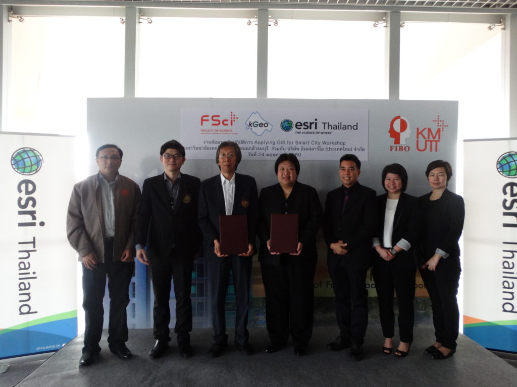
Appling GIS for Smart City Workshop
Date: 24 May 2017 Participant: 40 people Venue Room FB306, FIBO Building, 3rd Floor
Read more.